FRIDAY 23rd MARCH 2012
A trip to Pembrokshire has been well overdue so it would seem silly not to take advantage of the unusually hot weather for the time of year. I had arranged to meet
Taran at Dale, Milford Haven in south Pembrokeshire, the plan was to drive the one van up north to Fishguard and paddle back over the two days.
I couldn't wait to get on my way and arrived about two hours before Taran. I made use of the time and took to the water.
There was a little swell entering the huge port of Milford Haven so I had a little play rock hoping along some of the cliffs.
Heading back toward the beach I could see Taran hadn't arrived yet so I set off again exploring the surrounding waters.
SATURDAY 24th MARCH 2012
It was dark by the time we arrived at Pwllgwaelod on Dinas Head so spent the night in Tarans camper.
Morning arrived and the conditions looked promising. The forecast came over the radio before we left, force 3-5, 6 at times, moderate seas. Time of departure 8am, three hours before the turn of the tide, which meant we would have to round Strumble Head against the flow.
The south easterly wind certainly became evident when we left the shelter of the bay. We crossed straight over Fishguard Bay arriving on the other side flying along over 7 knots into a fast flowing counter eddy that runs along Pen Anglas head.
Dramatic steep cliffs and rugged headlands finally give way to a view of Strumble Head lighthouse. We pass through the inner island under the lighthouse access bridge and come across our first taste of rough water for the trip.
Looking back on Strumble Head.
Rounding Strumble Head our destined targets came into view on the horizon revealing the scale of our trip today.
After linking successive headlands with a mix of calm and rough water we take our first stop at Abercastle, a small sheltered fishing harbor.
Leaving the harbor we take a brief moment to explore some of the caves at the harbor entrance...
...before setting off again, chasing the horizon.
Each headland brings it's own dramatic natural architecture.
On the open water between headlands we were often joined by Fulmars, beautiful birds and experts on the wing, gliding effortlessly inches off the water around our boats.
Huge swells role in from the Irish Sea, ramping high up the cliffs.
Passing the old quarry building atop of Abereiddi one of the towering swells randomly breaks way off shore on our line of pass. That was enough to intimidate me in this unknown territory. Amusing as it was it would have cleanly wiped us out had we been ahead of ourselves.
We study the maps and take advantage of a last possible landing before rounding St Davids Head. After all the tide was at full flow and it can get absolutely huge off the head, especially as it was wind on tide.
Taran taking a moment to bask in the unusually hot sun.
The scenery along this stretch is dramatic to say the least. Huge cliffs rise steeply out of the water, my pictures don't do it justice.
Our speed picks up as we near St Davids Head. I'm sure I spot a fin some distance up ahead, but then put it down to my imagination, must have been a wave.
Then alongside a Porpoise (relative of the Dolphin) breaks the surface breathing out a spray of air. Then another and another, a pod of Porpoise, wow. This poor effort was the best I could capture on camera.
Picture by Taran
We round St Davids head, the water spikes up a bit but on known territory now we feel at ease it wasn't big today.
After a brief meeting with another group of kayakers we take advantage of another safe landing at Porthmelgan.
Time presses on and we need to get through Ramsey sound before the tide turns at 16:00. We head straight across Whitesnds Bay, past the jagged rocks of Carreg-gafeiliog and into Ramsey Sound.
We enjoy the calm waters sheltered in the narrow sound.
Rounding the end of the sound we paddle out into the exposed south facing side of St Brides Bay. Swell and wind create some confused water along this stretch and we hope to take a short cut through the island of Carreg yr Esgob. Moments after this picture above a huge swell smashes side on through this small gap forcing us to take the long route around the island.
Exposed to the huge swells we paddle through some of the roughest water of the trip.
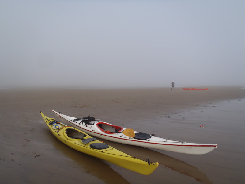
We were both glad to finally make it through to the sheltered waters of Porth Clais on the northern end of St Brides Bay, our camp for the night.
We were both looking forward to setting camp and getting out of our wet kit and into some clean dry clothes. Sadly my dry bag with my clothes in had let in the small amount of water that had come through my hatch , but was enough to completely soak all of my clothes. I tried to dry what I could with my gas stove to no avail and ending up spending the night in my damp clothes I wore under my dry suite.
Camp at Porth Clais
26.10 nautical miles (48km/30miles)
Total time 8:43:22
Moving time 07:40:32
Stopped time 01:02:50
Moving average 3.4 kts
Max speed 8 kts