After I had overcome the aches and pains of our
Ireland Crossing back in June I had the bug to do another challenge before the year was out. Anglesey looked possible. Not to far to travel, roughly the same boat time as Ireland and best of all would only need a day off work. Elan Winter was keen to do it with me so the planning began....
'When' was fairly easy. We both had a bit of time in September so looked to when the spring tides were. Weekdays were better for Elan to get off from work so we narrowed it down to two sets of dates which both fell on a Monday and Tuesday.
'How' was a little trickier. I had never paddled these waters so I was completely clueless where to start. I started to look at ways in which other people had done it when I came across a blog by
Kate Duffus. Her plan made perfect sense and the tides fell almost perfectly with the dates we had in mind. I armed myself with guide books, tidal atlas and charts and we were on our way.
Rather than follow Kate's plan to the letter we planned to leave our start point at Porth Trecastell on the south west coast a little later. So rather than catch the flow along the west coast as it starts to flood, the flow would already be flowing well giving us the best possible push up the west and northern shores. This was a bit of a gamble as it would only give us 7 hours to reach Puffin Island some 40 nautical miles away on the east coast. This would mean averaging around 6 knots per hour. This did have the added benefit of a few more hours sleep however.
'If' we managed to reach Puffin Island on time the tide would perfectly start to ebb down the Menai. If we kept a good pace down the straits the tide would be against for the final 10 miles back up along the south west cost to our starting point. The maximum tide rate here however is 1.5 knots so it wasn't a major issue. It all seemed to make perfect sense so it was time to put it into practice.
The first set of dates approached and we kept a keen eye on the forecast as it went from settled to unsettled. Monday 9th September looked the best of a bad bunch of days so we committed to it and travelled up still uncertain if the weather would hold.
We were unable to leave until late Sunday evening so arrived at our starting point at Porth Trecastell around midnight. We pitched camp, set the alarms for 5am and got our heads down.
The wake up call came way to soon but we broke camp, ate breakfast, packed our boats and we were on our way just after 6am. Elan seemed eager to get in his boat and get on the water, but from my experience with the Ireland crossing I knew what was coming as I looked down at the small seat I would spend the next 10-15 hours in.
Within half hour the sun broke out on the eastern horizon.
The forecast on the day was north easterly veering north force 2-3, increasing 4-5, 6 at times, slight becoming moderate. As we approached the first headland at Rhoscolyn there was no sign of any wind as we sailed through glassy waters.
Shortly after we took our first hourly break. Like the Irish crossing we would take hourly breaks on the water, usually about 2 minutes or so to take on board the necessary food and water.
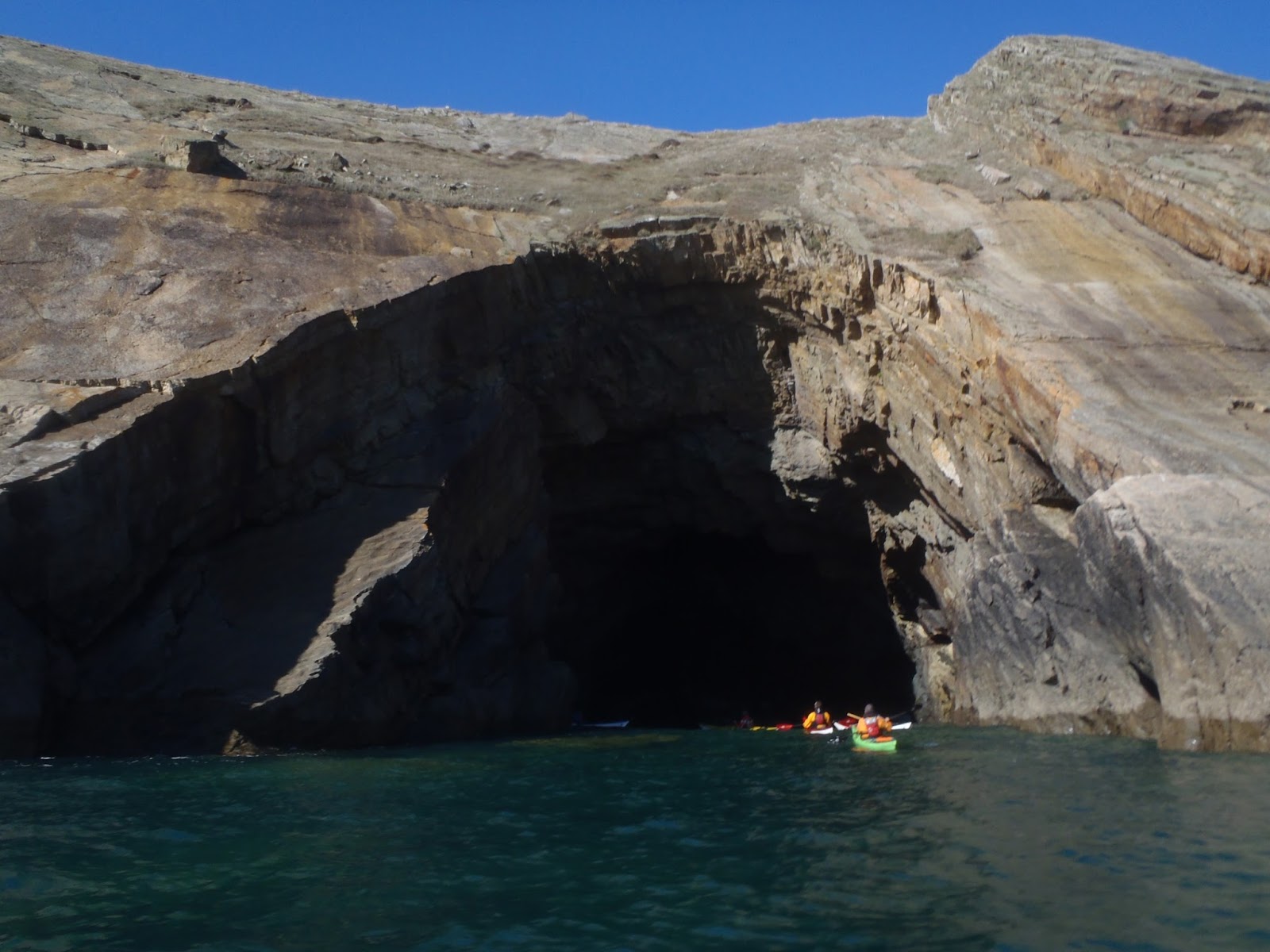
The next headland in our sights was the dreaded Penrhyn Mawr. I've had nightmares about this place and it's enormous tidal overfall's, not helped by the fact we could see the waves from 5 miles away. Thankfully we passed without too much action but could clearly see how this place could rear up in the right conditions.
We crossed the short distance over to South Stack where the northerly wind made it's presence known and the tidal flow was clearly evident.
We took the corner wide into the main flow and excelled our pace to over 10 knots continuing on to North Stack where we did the same.
Next was a good 6 mile crossing of Holyhead Bay. The Hollyhead to Dublin ferry was smoking away behind the breakwater and we hoped it wouldn't depart until we were were out of it's path, thankfully it left soon after. Our pace slowed slightly out in the bay but picked up again as we approached Carmel Head.
The Skerries we temptingly inviting but would wait for another day.
Along the north coast we passed through race after race, flying along averaging 7-8 knots all the way to Point Lynas on the eastern corner.
West Mouse above and approaching Point Lynas bellow.
Five hours in and we had already completed half of the south west coast and all of the west and northern coast. Feelings were flying high and the thought of a 10 hour circumnavigation crossed both of our minds. Our next destination Puffin Island was 11 miles away where the coast turns south west down the Menai Straits.
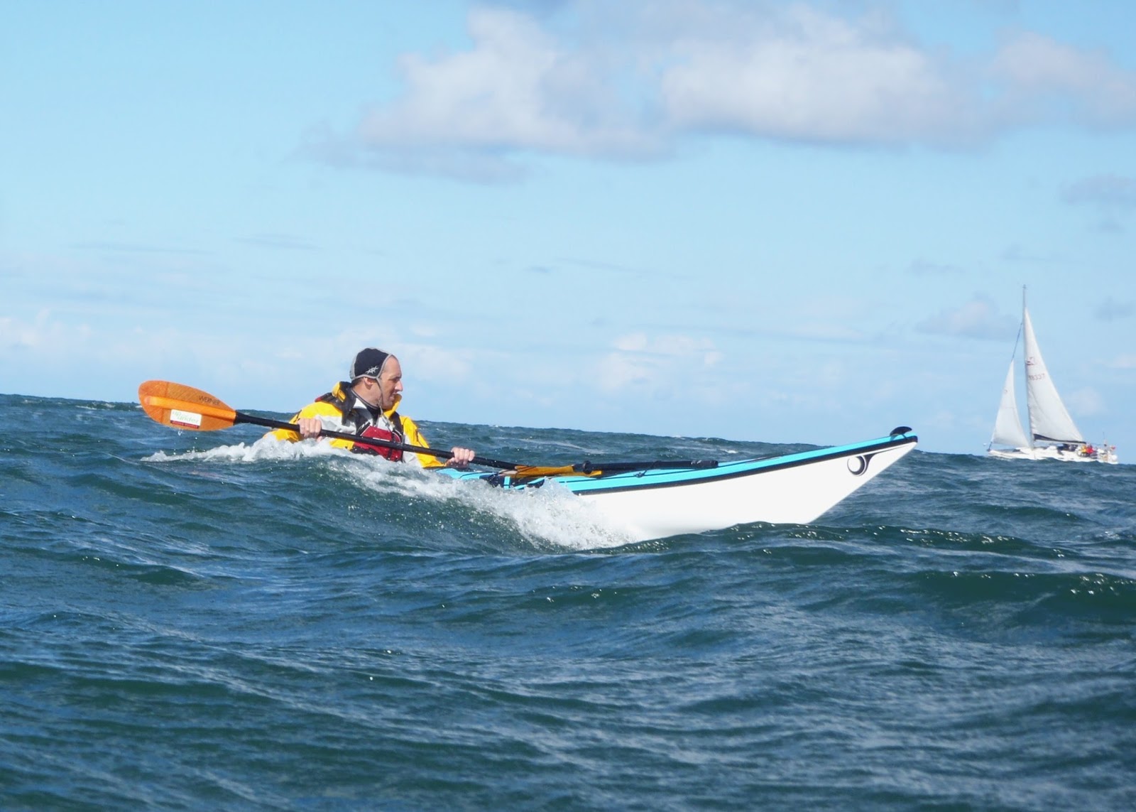
The wind picked up but was perfectly positioned to blow us down on to our destination. The following sea wasn't quite angled in the right direction but we made the best of any waves to push us along.
The crossing dragged on, the island never seemed to get any closer. The tide was dropping off and so was our pace.
We passed Trwyn Du light house and Puffin Island almost on the 7 hour mark just after 1300. So far the plan had worked and from my calculations the tide into the Menai had just started to ebb out.
Now sheltered from the wind, the straits were flat and calm so we landed briefly for a pee stop. The calm waters however did nothing to quicken our pace. We weren't moving. At 3 knots we slowly made our way down the narrow passage between Anglesey and the north coast.
It wasn't until the suspension bridge where the tidal flow took a hold, but when it did it didn't have shift.
The Menai seemed to go on forever. The overall pace had dropped through the straits and the hopes of a 10 hour circumnavigation were crushed. We were both feeling the strain by now. 13 hours was the realistic aim we had in mind at the start of this trip and it still looked possible we could quite easily do it in 12.
But...we had no idea what to expect when we left the mouth of the straits. We knew what tide there was would be against us and had hopped the southern shores would protect us from the northerly wind. Unfortunately we were spat out of the straits into a fierce head wind and our pace dramatically slowed to bellow 3 knots.
We pushed on through gritted teeth but the wind was unrelenting. We were unable to stop in fear of being pushed backwards. We reached what we thought to be our final headland, my step quicken knowing we were close to a 12 hour time. We reached the head and looked on, we weren't there yet. It's the next headland...or is it? We were uncertain, every bay look very similar out here. My GPS would tell us so I set a marker at the beginning of our track and set a path...12 miles!!! At our current rate it would take another 4 to 5 hours.
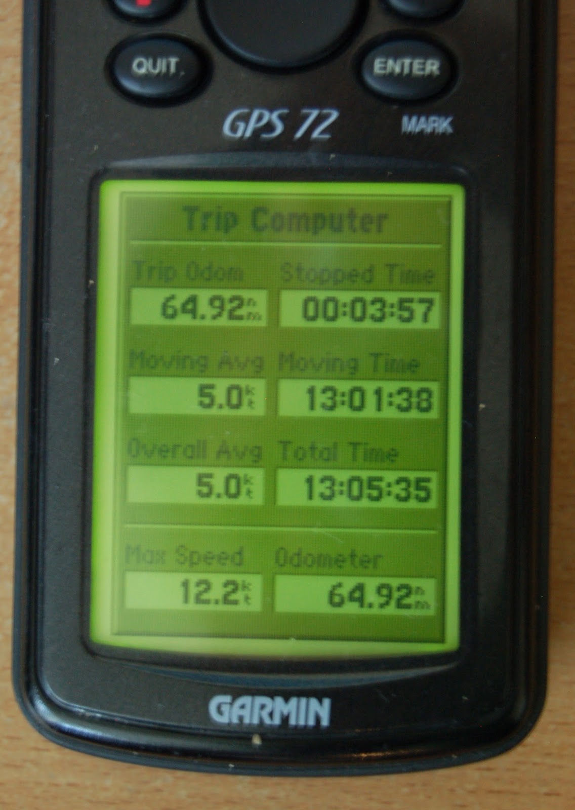
We pushed on toward the next head, hoping the GPS was wrong and we were right, neither of us had much left in the tank and the sun was quickly getting lower and lower in the sky. We looked on at the small sandy beaches around the final point in anticipation, there was the car, we made it! Like two old men we hoppled up the beach with our boats just after 1900 giving us an on the water time of 13:01.
It was still another 5 hours before we got to rest in our beds back in south Wales. A cracking trip but I think it's safe to say we wont be doing anything like that again for a while, well not until next year at least.
And the GPS....well I later discovered because the trip was so long it had used up the track memory and deleted the earlier tracks. It was pointing us to Carmel Head, which explains the 12 miles.