Sunday, 12 September 2010

Isle of Skye - Part 1

Back last year my dad said "do you fancy a trip up to the Isle of Skye, split the petrol I'll go walking you can go kayaking". After months of waiting the time to take the 600 mile trip up the the western isles of Scotland finally arrived. With 458 pictures taken I best get started.

DAY 1 - Friday 3rd September

We left early morning and arrived at Loch Lomond just the other side of Glasgow late afternoon. We found a camp site at the edge of Loch Long within walking distance of a pub and chippy, sorted!
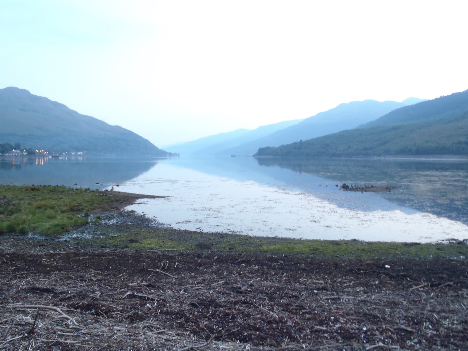
Loch Long

The camp site was a little run down but we were only staying the one night.

DAY 2 - Saturday 4th September

Buachaille Etive Mor
After a quick breakfast we past through the highlands of Scotland and make our never ending journey further north. We must have stopped at every lay bye for photo opportunities.

War memorial Spean Bridge, Ben Nevis behind

Bridge at Loch Sligachan, South East Skye

Loch Brittle Camp Site and the Black Cullin Mountains, Skye
We pitch my dads aircraft hanger of a tent at what must be the most spectacular camp site ever. It is situated in the shadows of the Black Cullin mountains and at the end of Loch Brittle (sea) Loch.

We then head to our nearest pub 8 miles up the road at Carbost for a few pints for my birthday before calling it a night.

Day 3 - Sunday 5th September

OK two days gone already and I haven't got my boat off the roof yet, time for a paddle. I catch the mornings forecast...force 5-6 increasing force 7, 50 mile hr gales from south east. Our camp site was facing south east so we drove up near the pub which looked more sheltered last night.

I launched or more like slid from the Talisker distillery in Carbost. And I thought Aberthaw was bad! Amazingly this was the storey for the whole coastline. Sea weed covered everything, you were luck if you found a sandy/pebble beach anywhere.

Looking toward the Black Cullins at Loch Harport

I made my way across the loch to the far side. My dad was coming back for me in about 6 hours so I tried to take my time but with a following sea and wind I was accelerated along at 5-6kts.

Way hay! a pebble beach, but I had to fight through the seaweed to get to it. Hannah bought me a water bladder which fits to my BA for my birthday, which is great as I don't lose my water bottles anymore and keeps me well hydrated. Down side is I have to stop for a pee every half hour!

Paddling in to Gesto bay with a nice looking guest house and the remains of Gesto House which is a listed building dating back to 1760 and was the former home of the Macleods of Gesto.

Gesto House

Carrying on my journey eastward I paddle into Loch Beag. There are no noticeable tides around most of Skye apart from obvious headlands and narrows so planning was a lot easier.

Whats with the slipways in Skye?! They all seem to drop off a few feet above the water level.

I make another seaweed covered landing next to the slipway for a quick cuppa and to plan the rest of my journey.
A flight of Shags (click the image you'll soon see them)
With the wind starting to pick up the further out I get I stay close to the shore line and carry on my journey out to the intriguing shaped spit of headland in the distance.

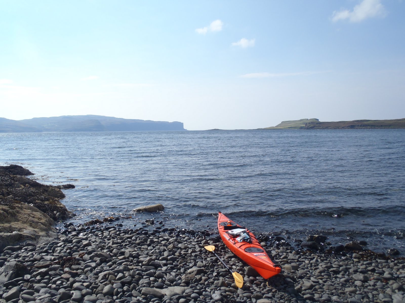
Nature calls again! Out here I feel more alone in a kayak than I ever have and start to get the feeling the remote western isles are not really a place to be kayaking alone. I haven't seen a single person or boat. The nearest thing to habitation I have seen was a lonely guest house back a few miles at Gesto Bay and a deserted harbour.

All this is forgotten when I find this gem of a beach dividing the tip of the headland. White sand, turquoise sea and stuning views of the surrounding highlands.

I climb up the hill to get a better view of my surroundings.

To the west stunning sheltered seas surrounding the isles of Harlosh, Tarner and the largest Wiay with the mountains of western Skye including Macleod's Table in the hazy distance.

Back to the East where I came from white wave crests now gust across the water.

I cheat and drag my boat across the beach to the more inviting western side, hopefully the wind will ease off a little by the time I get back.

The end of the headland looks inviting with calm waters sheltered by the huge cliffs.

Caves, cliffs and a slight swell coming in from the south I feel more like I'm at sea now. It's a weird place, you have the mountains, the heather, bogs and reeds, sheep and cattle all right on the waters edge. Somehow doesn't seem to fit. Later in the week I even saw cows wadding in the sea along a beach.
It looked a bit choppy further out but with only a 1.5/2km crossing to the isle of Wiay I chance it.

A few minutes into the crossing the gusts whip over the headland and make paddling difficult. The sea was by no means rough but the force of the wind was enough to make me feel uneasy in such an exposed and unfamiliar place. I turn back and battle into the wind back to the beach.
I hop back over the spit and carry on my paddle into the wind and head for a lighthouse across to the entrance of the loch.

The wind had eased slightly so made it a fun paddle into the oncoming waves.

The lighthouse turns out to be a un-maned framework tower powered by solar panels. Still a couple of hours left before my dad finishes his walk I decide to follow the coast south instead of heading back up the loch.

Past the huge cliffs of my intended destination of Wiay Isle, Macleod's Maidens come into view, also an intended destination for later in the week. The maidens are three sea stacks said to be named after the mother (the larger stack) and two daughters (two smaller stacks) of the Macleod family who drowned at sea many years ago.

The cliffs rise dramatically out of the sea now providing the perfect shelter from the south easterly winds.


I test out a three picture wide angle function on my camera. With the sea being so glassy and calm and a gentle following swell I make a bee line for the light house into deeper waters in the hope of seeing a basking shark or some dolphins. No such luck.

Rounding the headland off the lighthouse the wind gusts quite strongly making paddling really difficult. Just as I was about to start my 7km paddle back down the loch I notice my dad waving his red jacket from a slipway. Thank god for that I was dreading that paddle.

With the sun now behind us on the journey back the Black Cullin's make for a perfect photo opportunity.


Roughly 15nm trip over about 4 and half hours. It was back to our local pub for a few pints of Red Cullin and Isles Ale together with home made Angus burger and chips. On returning to the camp site the wind was whipping up a gale and we find our tent practicaly flattened. We spend a few drunken momments tying it up to the roofrack on the car and spend the rest of the night wide awake waiting for it to take off again. This was the start to a very wind week!!....

Sunday, 29 August 2010

Cardiff Harbour Festival

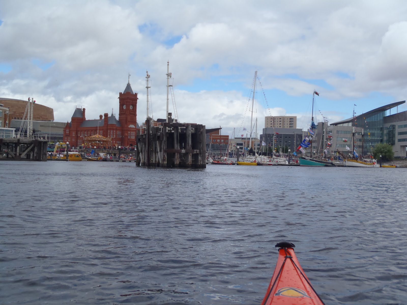
With the weather not really suitable for the sea today with a forecast for gales I didn't plan on going anywhere. Hannah and the kids were off to a kids party in Cardiff so I dropped them off and headed down to my usual launching spot on the River Ely. The Cardiff Harbour Festival was on this weekend so I went for a nose.

A few more restrictions that weren't here last time - 'launching of vessels is prohibited' sign and a large gate and tunnel leading to the landing jeti. I trod down a muddy path to the edge of the river to get in.

I paddled around the edge of the bay toward the festival as there were exclusion zones in place and yellow authority boats everywhere. Maybe if I stick to the sides they wont see my 15ft bight orange sea boat!

I paddle across the inner harbour past the tall ships and was approached by a patrol boat. A very nice gentleman explained there were exclusion zones in place as there were demo's on but if I want I can paddle over to the side and watch from there.

Even though I was in the sheltered waters of the bay the wind was still whipping up so I clung on to the old harbour timbers and watched a rescue dog performed some tricks. The patrol man came over again and said the Sea King rescue helicopter was about to come in an do a demo so sit tight and don't move. The RLNI crew also came over for a word and said stay where you are.

Still clinging to the timber the helicopter approached extremely close. Too close in fact as I was engulfed in a cloud of spray from the down drafts. The force of the drafts was amazing, I wouldn't like to be directly under it!

I let go of my support and let the drafts blow me back to the edge of the bay.


The helicopter did a few fly byes before heading off. An amazing experience to be up so close, and I felt a bit privileged to view it from the water.

I left my place after the helicopter flew off and carried on around the edge of the bay. There was a parachute jump next.

I crossed the bay back toward the Ely and Taff dogging various boats which were waiting for the event to finish before docking, one of which ignoring the patrol boats before being ushered back.

I'm glad I made the trip, being in such close contact with the Sea King was an amazing experience and one I hope I wont have to experience again for the wrong reasons.

Sunday, 22 August 2010

Steep Holm

The weather looked a bit more promising than yesterday, and with no plans I had a look at the tide times and forecast to see where I could go. I wounder if I could get to Steep Holm? Weather looked promising and if I was quick I could catch the tide. I packed up and got a lift with the Mrs down to Penarth.

At the edge of the slipway I look out across the 6nm (11km) past Flat Holm to Steep Holm. The water was glassy and calm. I've wanted to get to Steep Holm for ages having been to Flat Holm many times previously.
I left two hours before the start of the flood tide to allow plenty of time to get to my destination. After a quick 40mins I was at Flat Holm. I didn't plan on landing on Flat Holm but my bladder thought differently. Forecast came through on the VHF "possible force 7 gales later", hopefully "later" I'll be at home with a cup of tea!

Paddling to the far east side of Flat Holm my destination comes into view 2nm (3.7km) ahead. I felt a little apprehensive... will I be dragged too far south with the current? what if a ship comes up this busy shipping lane? All these questions playing on my mind.

No need to worry though, half hour later I was at Steep Holm. Makes me think why I haven't bothered to make this extra 2nm crossing previously. There was a slight race on the eastern side of Flat Holm but apart from that a completely smooth journey.
I land on the stony beach and with about forty minutes until the tide turns I have lunch. Sitting here I realise England is now a lot closer than home (obvious I know). I can clearly make out the pier, the big wheel and even windows on the buildings at Weston Super Mare.
I climb up on a rock just bellow this spooky old building and have lunch when I notice a RNLI life boat approaching. I walk down to the beach as a crew member swims ashore. He came to see if all was ok and if I was aware of the force 7 gale that was coming in soon.
With all the gates locked leading up the path on to the main part of the island I decide to leave not long after not to be caught out in a gale.
Looking back at Flat Holm

Western Super Mare
Steep Holm as it's name suggests rises 70m above the sea. It has been occupied by 12th century monks, WWII soldiers and now is home to two wardens. As with Flat Holm the island is covered in various fortifications as part of a defensive chain of the Bristol Channel in the 1860's. Unfortunately I will have to leave any exploration until next time.

Rounding the southern end of the island I reach Rudder Rock, named as the parallel plates of rock resemble a rudder. Once again pictures like this don't do the size of these rocks justice.

Around Rudder Rock and I can just make out the stadium and tall city buildings of Cardiff beyond Flat Holm.

Looking back at the steep cliffs with the second largest tide mark in the world.

The shipping buoys between the two islands remind you to look out for these!

Once again in line with Flat Holm I am quite far south of the island. As I left slightly early the tide took me slightly south which isn't a big deal because it'll soon pick up in the next hour of paddling taking my back north toward Penarth.

I landed at Penarth after an hour and a quarter with the tide pretty much where I left it.

A total 13.18nm (24.5km) trip in perfect conditions, although perfect is starting to get boring if I'm honest. That force 7 gale turned up today! (Monday). A brilliant trip and an achievement I've left too long.

It was a trip to the park on top of the hill for Zakk and Connor before heading home for a well deserved rest.

Wednesday, 18 August 2010

Whitesands Bay 15/08/10

After much discussion we decided to simply take a paddle out from Whitesands at the camp site and paddle around the bay. With another strong northerly wind our options were again limited. The tide was now flowing at full pace through Ramsey sound at spring tides so there was no chance of getting through. There was only four of us today, just a quick morning paddle before heading home.


We paddled south toward the top of Ramsey Sound before paddling back to the small rocks of carreg-gafeilliog.


There was a small race just between the rocks.


A bit further out from the rocks the tide was whipping up some massive waves as the water rushed out from the sound into the oncoming wind.


We had a little play with the small standing waves before paddling across the bay toward St David's Head.


Paddling into the wind we rarely got above 1.5 to 2kts but with a bit of a following swell we made headway.


Landing at the stunning secluded beach of Porthmelgan we stop for a stretch.

I have previously noted this bay as a possible camp site on my map and I think I will definitely do that one day.

Paddling out from the bay we head back around toward Whitesands beach taking in some impressive caves on the way.

Unfortunately my camera battery died here but probably for the best, I get a bit trigger happy sometimes. We went into one cave only just wide enough to get a kayak in, but it went back miles. We slowly paddled in until it was too dark to see any more and we still didn't reach the end! Will have to come back with a torch.

Only a short trip to finish off the weekend before traveling home. A nice weekend in all, cheers everyone. Next the isle of Skye...