Tuesday, 7 December 2010

Freezing Fog

As I watch my business fall to its knees due to the 'big freeze' I decide to go for a paddle to remind me there's more to life than work and money. I leave a sunny clear St Athan for Sully to paddle my worries away.
Unfortunately the closer I got the Barry the thicker the fog got. Sully Island wasn't even visible from the car park. What the hell, I'm here now.

It was showing -5*c on the van thermometer, wind force 3 on the forecast and zero visibility. I hand railed the shore line so not to get lost in the thick fog.
Up ahead Hayes Point slowly came through into view.

Reaching Bendrick Rocks it got a little choppy. Nothing really but when you can't see much in front off you it's a little daunting not knowing whats to come.

Around Bendrick Rocks and Barry Dock light house now coming through the fog.

It was now reaching the turn of the tide and it's getting bloody cold so I think I'll turn around.

I stop off for a quick chat with Craig off the Barry Pilot Boat before heading back. I think "your mad" were the words he used.
Out of the docks and into a freezing northeasterly wind but at least it cleared the fog a little.

Sully Island now coming into view and the wind getting stronger. My camel pack had completely frozen up and I could feel the tears running down my cheek instantly freeze. Even the salt water splashes on my buoyancy aid started to frost over.

Low water spring tides equals extremely long carry back to the van!

The water frozen in my hose! Not a huge paddle only 5.5 nautical miles but it put a smile on my face none the less, even if it is frozen on.

Sunday, 5 December 2010

Sunrise to Sunset

Only in winter can you easily paddle from sunrise to sundown. Crisp frozen mornings, deserted beaches and quite seas, sun low in the sky highlighting imperfections in the cliffs, mist rising off the water. I love paddling in the winter.

No plan today just park up at Gileston beach head straight out and let the tide decide. I asked Taran if he wanted to join me, check out his new blog here. The sun peaked above a low band of cloud as we set off west with the ebbing tide.

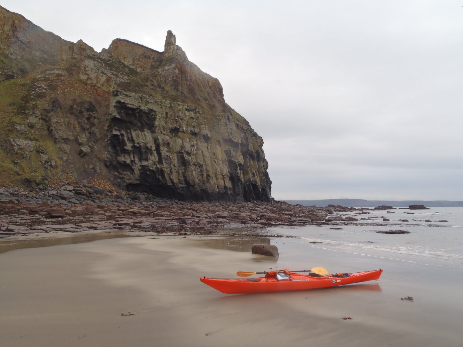
The yellow Jurassic limestone cliffs glowed in the low morning sun. 199-145 million years ago this area would have resembled a desert landscape with warm seas like the Red Sea, far from that today. Force 2/3 was the forecast on the books for today, it doesn't get much better than this in December.

Before we knew it the spring currents had taken us as far as Nash Point.

We stopped off and scaled the over photographed cliff to check if the sand bar had surfaced. Just a lot of surf so we carried on to Southerndown.

From southerndown we aimed our boats directly out to Tusker Rock, which was only just visible on the horizon. It was now slack water, the tide was about to turn and we had another half hour paddle before we reached the rocks. The only ripple in the water now was caused by our boats.

We stopped off for some lunch and gazed out to the lighthouse far in the hazy distance realising how far we had to paddle back. With the turn of the tide the water now had a slight ripple and small following wavelets, which we used to our advantage together with the ever increasing flow of the spring tide. We aimed directly for the end of the headland at St Donats to make best use of the flow.

Without little effort we were hurtled toward the east Nash buoy almost colliding with it at an average of 7kts. A bit of excitement for the trip at least.

We rounded the headland and stopped for a stretch next to St Donats slipway.

A swell had picked up as we approached Llantwit Major further aiding our paddle.

The slog from Llantwit Major to Aberthaw seemed never ending as it always does. With a final push we landed on the sands at Gilestone, any earlier and we would be up to our necks in mud.

Well it was almost sunset, another half hour and it would be. Taran stuck around for the sunset pictures whilst I set off for home for a warm bath! A marathon 22.57 nautical mile round trip (41.8km/25.97miles), not bad for a cold winters day. Top speed recorded 9kts.

Sunday, 21 November 2010

St Brides Bay, A Journey Back In Time


St Brides Haven
I leave St Brides Haven with the aim to bridge a section of the Pembrokeshire coast I have yet to complete from here to Solva, otherwise known as St Brides Bay.

Stack Rocks from Halfway Rock (the Camel formation is clear to the left of Stack Rocks)
Forecast wasn't the best but with five kids currently over my house I take my chances and escape the madness. Force 4-5 possible 6 North Easterly, sea state moderate, showers. I figured this section of the coast should be mostly sheltered from the worst of the winds.
Syncline fold in the Old Red Sandstone
The geology either side of St Brides Haven is mainly Old Red Sandstone, which make the cliffs really stand out.

Nearing Mill Haven you can clearly see where the Old Red Sandstone ends and is replaced with the Grey Igneous Rock of the Pre-Cambrian period. It was a really dull miserable day, not good for taking photo's.

Through Howney Stone opposite Stack Rocks the sea state picked up with brisk wind causing waves to break. A lone Razor Bill was bobbing about in the waves, most have now migrated for the winter.

The grey igneous rocks are now distinctively different to the deep red cliffs near St Brides. This irregular belt between Mill Haven and Little Haven is known as the Johnston Series and are the oldest rocks in Pembrokeshire (well over 1,000 million years).

The old igneous headlands are more typical in the north of Pembrokeshire, Dinas Head, Stumble for instance. South Pembrokeshire is mainly made up of sediments which are much younger.
From Musselwick just before Little Haven the geology turns to 'coal measures' made up of Sandstone and Shales, Millstone Grit and thin Anthracite Coal Seams. These are the youngest rocks in Pembrokshire (280 million years old).

I got very close to an Otter in this cove, I don't think he saw me. Although by the time I removed my gloves to get my camera out he disappeared beneath the water.


Layers of alternating stone can clearly be seen here up on the cliff. Black Mudstone collected on the sea floor then as they shallowed a thin layer of fine sandstone sits on top. Thick layers of Sandstone lay on top of that from delta deposits, bleached due to leaching in a tropical environment.

Extreme folds in the sediment can be seen at either ends of the bays at Little and Broad Haven.


Shag Rock with Broad Haven in background
It's now easy to understand how St Brides Bay has been formed. The brittle softer rock has given way to the ongoing pounding of the sea forming shallow bays cut into the coal measures leaving harder sandstones at the headlands.

Sleek Stone
At the end of Broad Haven beach is an impressive Monocline formation (asymmetrical up-fold in the strata) known as Sleek Stone. The rock resembles a huge beached whale with a big bite out of it!

Following the coast toward Druidston, named after a 12th century knight who settled here, the cliffs show more evidence of the erosion that continues to eat away at the cliffs.

Haroldston Bridge
It is now low tide so I am unable to pass under Haroldston Bridge, a natural arch linking a small rocky outcrop to the main cliff.

I stop off at a small inaccessible bay just prior to Druidston Haven but it's too cold to stop for long. I don't know why maybe it's the miserable weather but I didn't have the motivation in me to carry on any further. So I continue on a little further with Rickets Head south of Newgale in view before turning back.

I paddle into the small sheltered lagoon under Haroldston Bridge on the way back for a cuppa to warm me up.
Whilst having a cuppa I caught a sight of a Peregrine leaving the cliff with what looked like a small bloodied rodent in it's talons.

Passing Broad Haven the surf which was more evident earlier had ceased so I landed at Small Haven in front of this impressive looking cave.

Continuing my journey the sea state got worse the further south I went. I decide not to make the small detour out to Stack Rocks.

I chased this Curlew most of the way back, every time I got within shooting distance he flew off. I finally managed to get this shot.

It made for some good rock-hopping opportunities amongst the red stones with the tide being so low. It also kept me out of the wind.

Typically the sun decided to show it's face when I got back to St Brides Haven so I took a short walk up the coastal path to The Nab Head.

St Brides Bay and Stack Rocks

Ramsey Island basking in the sun

There was a Kestrel hovering above the cliff who didn't seem bothered about my presence. A bit further along two pigeons flew down amongst the cliffs at break neck speed quickly followed by another Peregrine. Good day for wildlife!

So I didn't get to my intended destination but I had an enjoyable paddle none the less. I saw my first otter and got a few glimpses of some fascinating birds that occupy this coast. Please correct any of my geological jargon if I'm wrong, I'm learning.

Sunday, 14 November 2010

Light at the End of the Tunnel


Another late afternoon paddle, trying to make the most of what light remained. The reflections were great for taking photo's.

I did a lap around the bay before heading back up the River Taff. I kept myself entertained listening to my VHF, there was a boat on the other side of the barrage in need of assistance from the lifeboat.

Under the bride near the Millennium Stadium there was a flashing glow at the other end.

I reached the stadium and turned back.

Reaching the slipway it was now pitch black. The link road bridge was now lit up like a runway. Another relaxing paddle on the water to get me away from the commotions of life.